
Lafayette Weather – Storms, Flood Threat Continues
The Acadiana area went almost two weeks without even a sprinkle, Mother Nature is making up for lost time this morning. An area of low pressure currently centered over east Texas is the catalyst for the very heavy rainfall and copious amounts of thunder and lightning many of experienced early this morning.
This system is the reason a Flash Flood Watch has been posted for much of South Louisiana until at least tomorrow. Rainfall totals in the area could exceed 4 or even 5 inches before the system moves out later in the week.
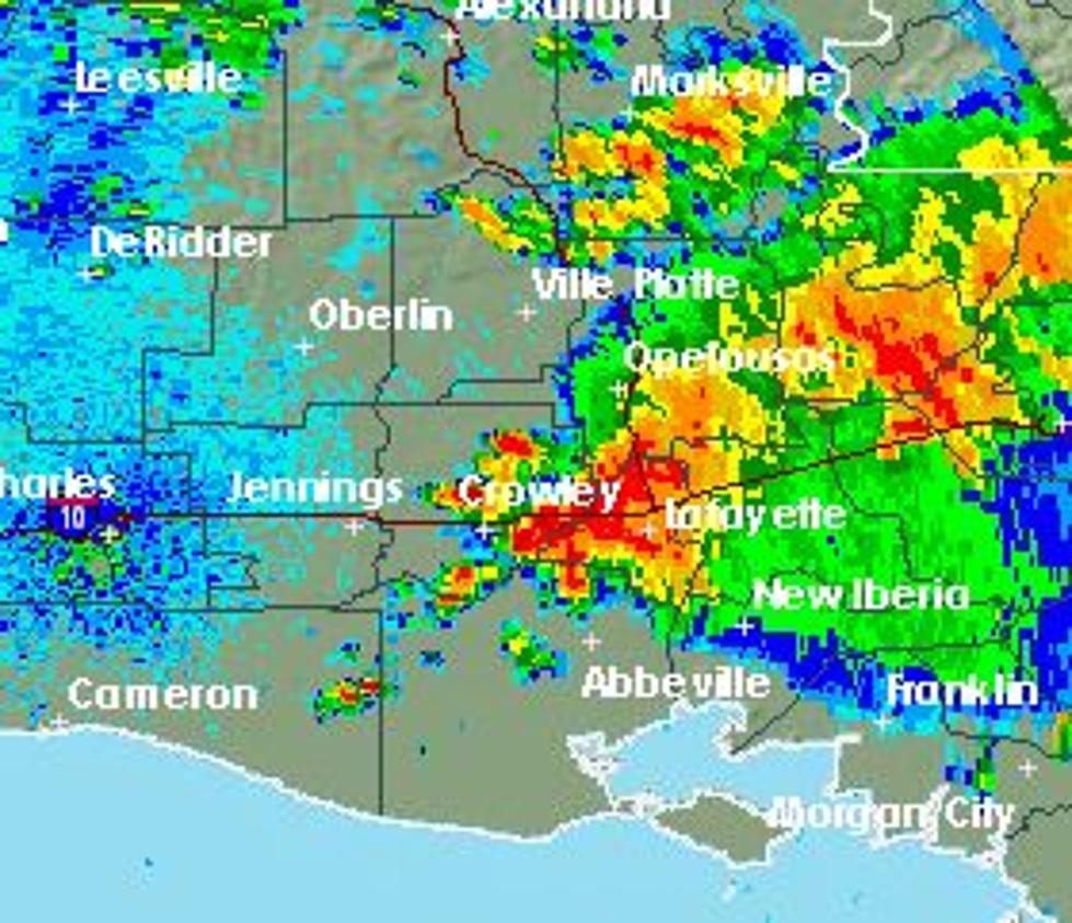
Currently the National Weather Service radar and the KATC Power Doppler HD are showing significant thunderstorms moving through the area. The potential for heavy rain and strong thunderstorms is expected to remain in the area for the next several days.
One cause for concern is the possibility of thunderstorms "training' across the same area for several hours. Currently storms are forming in eastern Cameron Parish and moving northeastward across Vermilion and Lafayette Parishes. If this pattern becomes consistent the potential for flooding rains is possible in these areas.
The Storm Prediction Center has South Louisiana under a slight risk of severe weather during the day today.
More From 97.3 The Dawg


