![Tropical Development Possible Off Louisiana Coast [Updated]](http://townsquare.media/site/33/files/2016/08/Tropics-27-Aug-1.jpg?w=980&q=75)
Tropical Development Possible Off Louisiana Coast [Updated]
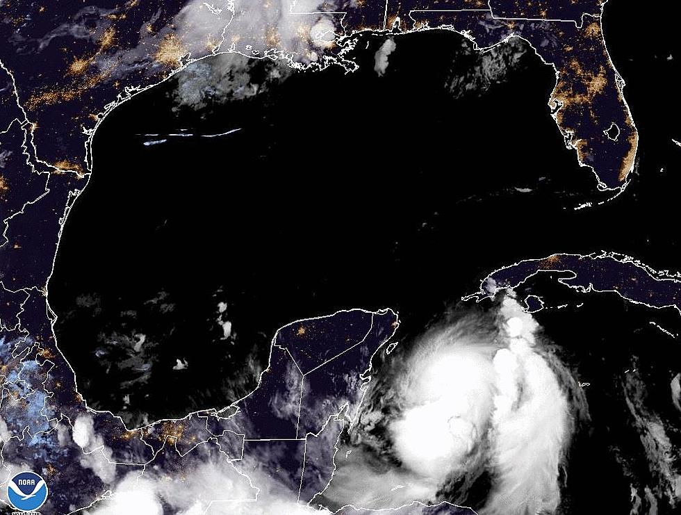
[Updated 5 AM Saturday August 27,2016] Forecasters with the National Hurricane Center continue to monitor an area of disturbed weather just south of the Louisiana coastline. At the 2 AM advisory forecasters put the center of circulation about 100 miles south of the Louisiana coast.
On a normal Summer weekend, this weak trough of low pressure wouldn't be much cause for concern. Since our state has had to deal and is still dealing with rivers, creeks, coulees, bayous, and some neighborhoods still experiencing high water even the threat of a little more rain is a serious one.
Forecasters do not believe this area of low pressure will become a tropical cyclone. The Hurricane Center has given the system a minimal 10% probability of actually getting stronger. The movement of the system during the day on Saturday is expected to be away from the Louisiana coast. That motion, a general westward motion, should carry the system near the Texas coast by Sunday.
The forecast for South Louisiana continues to hold a significant threat of heavy tropical downpours. These rain chances and rainfall totals will be enhanced by the close proximity of this area of disturbed weather. Forecasters believe that the majority of the heavier showers and thunderstorms will remain in the offshore waters. It won't take much of a downpour over parts of the region to exacerbate the high water issues the area is already experiencing.
[Original Story from 08/26/2016] At what point does Mother Nature want us to yell "Uncle"? It's not like we didn't have enough to be concerned with already, now there is a potential tropical trouble spot perched just off the Louisiana coastline.
The good news is this, it should not become anything more than a catalyst for a few more afternoon and early evening showers or thunderstorms. Granted we really don't need anymore of those either. This system should move quickly to the west over the weekend and cause more showers for the upper Texas coast.
Here is what forecaster Berg had to say about this particular system during the 2 AM tropical update from the National Hurricane Center.
An area of disturbed weather is located over the northern portion of the Gulf of Mexico. Surface pressures in this area are high at the moment, and little to no development of this system is expected before it reaches the coast of Texas over the weekend.
*Formation chance through 48 hours….low… 10 percent.
*Formation chance through 5 days……..low….10 percent.
The current National Weather Service radar scan from Lake Charles shows most of the heavier shower activity is moving from east to west and staying along the coast or just offshore. As you might expect rain chances are slight higher in Southwest Louisiana than they are east of I-49.
More From 97.3 The Dawg


