Tropical Update – System To Strengthen In S.W. Gulf Of Mexico?
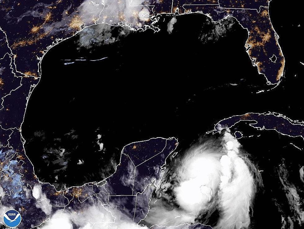
Tropical systems are truly a mystery when it comes to forecasting. There are so many variables that have to line up exactly right for a system to develop. It takes just as many coincidences for forecasters to accurately predict the path and strength of each system. Currently the National Hurricane Center is watching an area of disturbed weather just off the eastern Yucatan Peninsula.
This system rolled off the coast of Africa about this time last week and has slowly meandered across the Atlantic and into the Caribbean Sea. At no time during it's transoceanic crossing did the storm system show signs of getting stronger until now.
Here is the kicker, the system is expected to move ashore in Mexico later today. That would usually be the end of a weaker tropical system, being over land for a few days. However, this sneaky system is expected to stay loosely organized and emerge into the Bay of Campeche early next week.
Conditions in the Southwest Gulf of Mexico are very conducive for tropical development and the Hurricane Center is projecting a 50% chance that this system could get organized into at least a tropical depression.
Right now the forecast models show a continued movement to the west through the Bay of Campeche and into Mexico. If that happens the system would just be a prodigious rain producer in the mountainous areas of that country. However, anytime a system is in the Southwest Gulf of Mexico it bears watching here in Louisiana.
History has taught us that tropical systems can fire up and strengthen very quickly in that particular environment and if the steering patters change even slightly this system could become a problem in a hurry for the Northern Gulf Coast.
Again, we're not trying to sound alarmist, but we do think keeping an ear on 97.3 The Dawg and our weather partners at KATC over the next few days would be a very prudent thing to do just in case conditions do change.
More From 97.3 The Dawg


