The threat level for strong storms has been increased for Lafayette, Lake Charles and Baton Rouge today. Here's when the worst of the weather is most likely to move through.
An approaching cold front will interact with Gulf moisture and an upper level trough to give South Louisiana residents a significant threat of rain today and tomorrow.
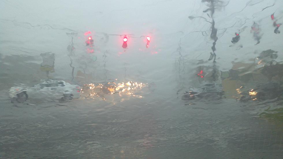
Heavy rain, flashes of lightning and loud claps of thunder, that's how we're starting the day in Acadiana on this Wednesday morning. A flash flood watch remains in effect for the area.
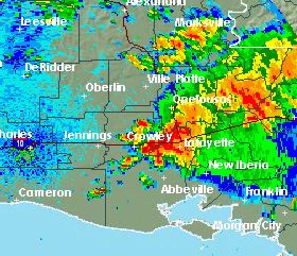
A large area of rain and thunderstorms is moving on shore this morning. Will this wash out your Sunday plans? We've got the forecast and the latest radar scan.
Lafayette's weather forecast may have suffered a bit of jet lag because of the change to daylight savings time over the weekend. A frontal system that was forecast to move through the area Sunday afternoon and evening slowed down just a bit and has pushed the exit time of the showers and thunderstorms to later today.
...
We advise parents to send kids to school with a jacket even though the temperature at bell time this morning might not be that cold. Falling temperatures and gusty North winds will make this afternoon quite chilly across the region.
The Storms Prediction Center is predicting a slight risk of severe weather generally along and north of the Highway 190 corridor. Those living south of 190 could experience heavy storms as well, just maybe not severe.