
Wind Shear Is the Only Brake on Gulf Storm Becoming 2026’s First Hurricane, Expert Says
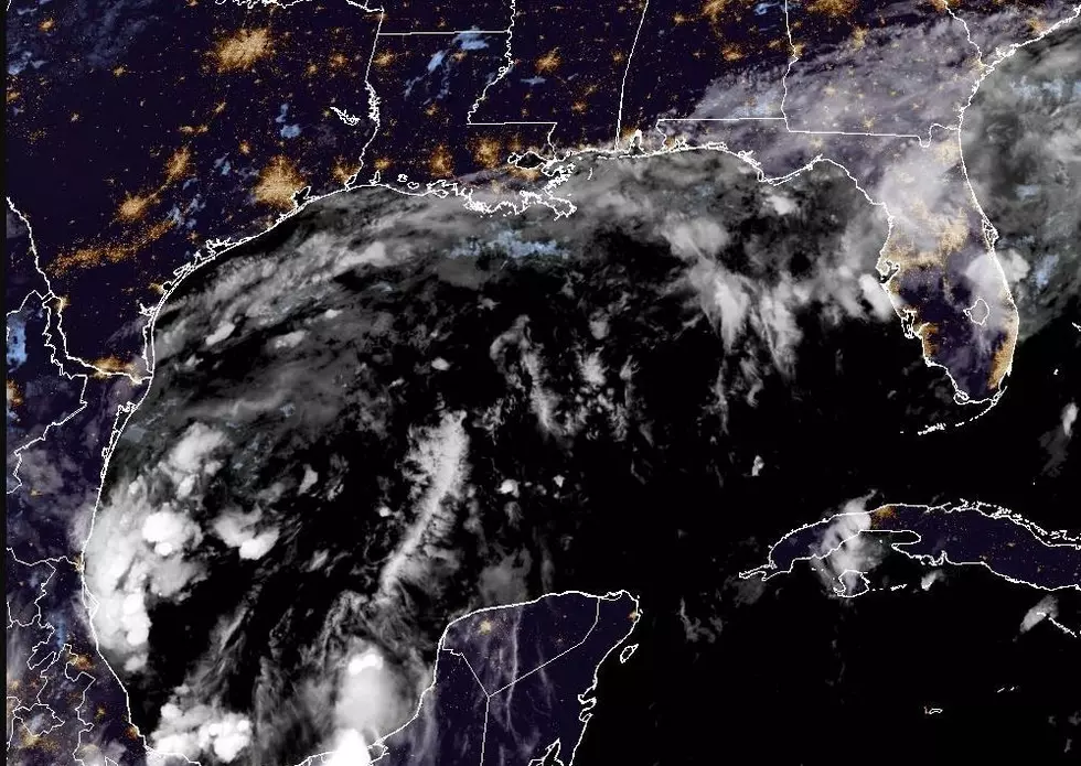
LAFAYETTE, La. — A cluster of thunderstorms in the Bay of Campeche is forecast to organize this week into Tropical Storm Isaias. AccuWeather meteorologists believe it will likely strengthen into the first hurricane of the 2026 Atlantic season before reaching the central Gulf Coast this weekend. Landfall is projected somewhere between southeastern Louisiana and the western Florida Panhandle.
For Acadiana, rain chances climb Friday and Saturday, though forecasters expect the heaviest impacts to stay east of the area. The system has not yet become a named storm, and uncertainty remains high on both its strength and its track.

Where the Gulf System Stands Tuesday
The National Hurricane Center is tracking the disturbance as Invest 92L and gives it an 80% chance of developing within 48 hours as of early Tuesday, the same odds it carries over seven days. Hurricane hunter aircraft are scheduled for Tuesday afternoon to measure how favorable or hostile the surrounding air is.
Wednesday is a key day for development. The system begins to meet El Niño-driven wind shear and dry air, which have suppressed the Atlantic season overall. A more defined center would help it hold up against those conditions.
What Acadiana Residents Need to Know
Acadiana forecasts keep the greater impacts east of the area, with rain chances rising Friday and Saturday. The GFS model shows a formed tropical system near the southeast Louisiana coast late Saturday.
Donald Jones, a meteorologist with the National Weather Service in Lake Charles, expects the system to develop Wednesday or Thursday and says it could reach the northern Gulf Coast Friday or over the weekend. A cold front that passed Sunday left strong upper-level wind shear just offshore, and Jones said that shear could tear the system apart. If it does, heavy rain becomes the main threat.
The Lake Charles area is forecast to stay dry ahead of the system, with temperatures near 90 degrees by Wednesday.
Where Landfall Is Forecast Along the Gulf Coast
AccuWeather’s track puts landfall between southeastern Louisiana and the western Florida Panhandle. Vice President of Forecast Operations Dan DePodwin said landfall is currently expected early Saturday morning, probably as a strong tropical storm. A dip in the jet stream coming from the Plains and Mississippi Valley should pull the system north and onshore.
Model tracks run from the upper Texas coast to the Florida Panhandle, with more of them trending toward the Panhandle. Forecasters have also laid out scenarios for the storm. In one, a depression or storm weakens before reaching the coast. In another, Isaias comes ashore between Louisiana and the Panhandle with strong winds and storm surge on top of heavy rain.
Rain, Wind and Surge Forecast for the Gulf Coast
Heavy rain is the biggest threat in AccuWeather’s forecast, especially where the ground is still saturated from drenching rain over the past week. Rainfall of 1 to 4 inches is forecast across a broad area of the Southeast, with bands of 4 to 8 inches and 8 to 12 inches near and just east of the center’s track. AccuWeather’s Local StormMax for rainfall is 25 inches.
NOAA’s Weather Prediction Center has issued a Level 2 out of 4 flash flood risk for parts of the Southeast on Friday and Saturday.
If the storm reaches Category 1 strength and holds it near landfall, gusts of 60 to 80 mph are forecast near and just east of the center, with a Local StormMax gust of 100 mph. Tropical-storm-force winds of 40 to 60 mph would reach a wider zone of the Southeast. Rapid strengthening to Category 2 or 3 would bring serious wind damage and moderate to major storm surge flooding near and just east of landfall.
Swells moving ahead of the storm will endanger small craft and bring frequent, strong rip currents to Gulf beaches, especially on the north-central and northeastern Gulf.
Why a First Hurricane This Late in the Season Would Be Rare
No hurricane has formed in the Atlantic this year. The latest first hurricane on record came Oct. 8, 1905, and AccuWeather says a hurricane from this system would be the latest first hurricane in more than 100 years. Only 1907 and 1914 finished without a known hurricane, and both came before weather satellites.
September ended without a hurricane for the first time in 32 years, and Gulf water temperatures are the warmest on record dating to 1982. AccuWeather Lead Hurricane Expert Alex DaSilva said, “The only inhibiting factor will be varying amounts of wind shear.” If shear increases enough along its path, the system could still fall short of hurricane strength.
Timeline for Acadiana and the Gulf Coast
Tuesday through Thursday: Hurricane hunters are scheduled to sample the system Tuesday afternoon. The National Hurricane Center expects a tropical depression within the next couple of days, and the system would take the name Isaias if it reaches tropical storm strength.
Friday and Saturday: Rain chances climb across Acadiana, and Louisiana impacts could begin as early as Friday night. Landfall is currently forecast for early Saturday, Oct. 10.
Weekend into early next week: The system is expected to move over the interior Southeast and perhaps as far north as the Ohio Valley, then turn east across the Appalachians and off the mid-Atlantic coast by early next week. Localized flash flooding is possible in steep terrain and where the ground is saturated.
What Happens Next for Acadiana
Tropical storm or hurricane watches could go up as early as Wednesday evening if development continues, and the National Hurricane Center will issue advisories as the system organizes. Track and strength details can still change, so Acadiana residents should keep checking updated forecasts.
You May Also Like...
- Overnight Update – Tropical System in Gulf Poised to Strengthen
- National Hurricane Center Tracking Potential Tropical System Moving Into Gulf Waters
- Will Acadiana See a Hurricane in 2026? What the Forecast and History Say
Most Feared Weather Events in Louisiana
Gallery Credit: Joe Cunningham

More From 97.3 The Dawg