
Hurricane Hunters To Fly Into Disturbance In The Gulf Today
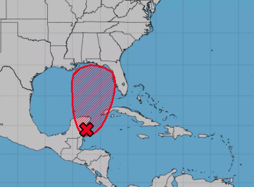
That area of disturbed weather that forecasters have been watching since the beginning of the week is about to get a little internal probe. Invest 90L as it is designated by NOAA and the National Hurricane Center will receive a visit from Hurricane Hunter aircraft later today.
The system is currently located just east of the Yucatan Peninsula in Mexico and is expected to move in a northerly direction over the next few days. The data collected by the Hurricane Hunters should give forecasters a better idea of how strong the system actually is and also where the exact center of circulation is located.
The forecast models are slowly coming together in agreement on the track of the system. The European Model continues to put the center of the system onshore sometime Tuesday near the Mississippi Alabama border.
The GFS Forecast Model has the system moving a little faster and even further to the east. Based on the GFS solution the center of circulation would cross the coast near Panama City Florida at sometime on Monday.
The multitude of "spaghetti models" seem to agree that the northern Gulf Coast, most likely east of New Orleans and west of Apalachicola Florida, appears to be the most likely places for a landfall from this system.
More From 97.3 The Dawg


