Hurricane Watches Posted For Florida Ahead Of Michael
It was about this time last week that we were telling you about an ominous feature that was showing up in some of the long-range tropical weather models. Sometimes these long-range prognostications don't hold water. In this case, the European Model was spot on in developing a broad area of low pressure into a tropical cyclone.
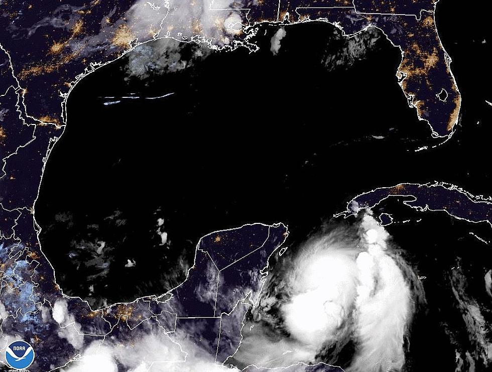
Tropical Storm Michael is basically a Category 1 hurricane early this morning. The system's maximum sustained winds at 4 AM were 70 mph. That's just four miles an hour shy of hurricane intensity. The storm is expected to grow stronger as it moves between Cozumel Mexico and Western Cuba into the Gulf of Mexico today.
The National Hurricane Center has posted a hurricane watch from the Alabama/Florida line eastward to the mouth of Suwannee River. A tropical storm watch extends westward from The Alabama/Florida line to the Alabama/Mississippi line. Forecasters believe hurricane and tropical storm conditions could be expected in those areas in the next 24 to 48 hours.
It does appear as if Louisiana has dodged what could be the last tropical bullet in Mother Nature's gun for 2018. The season typically wanes tremendously after the middle of October and the final six weeks of a typical hurricane season are usually quite calm, at least as far as the Gulf of Mexico is concerned.
More From 97.3 The Dawg


