Keep An Eye On The Gulf Next Week
History suggests that the Gulf of Mexico and the northwestern portion of the Caribbean Sea are traditional "hot spots" for tropical systems to develop early in the tropical season. History appears to be right on target based on what forecasters are watching this weekend.
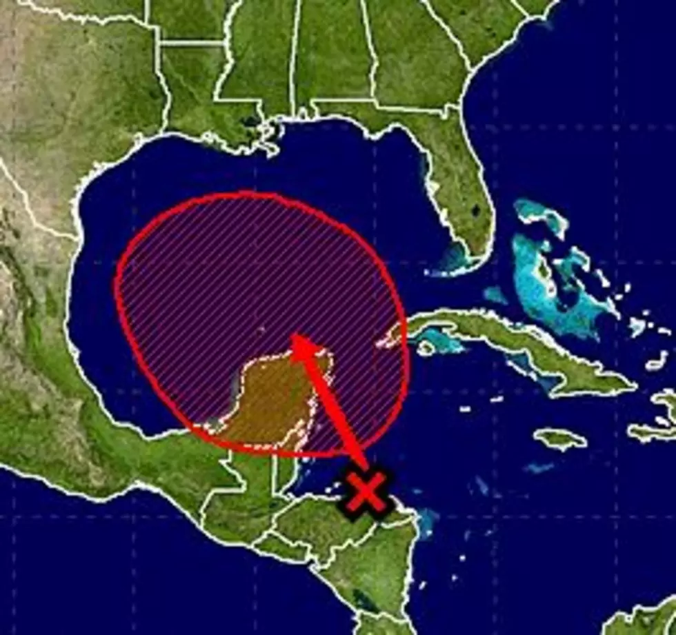
There are two systems that the National Hurricane Center prognosticators believe have a very good chance of becoming a tropical cyclone. That means a tropical depression, a tropical storm, or a hurricane. One of those systems is in the low latitudes of the tropical Atlantic. The other is expected to move across the Yucatan Peninsula and into the Gulf of Mexico next week.
Forecasters have given the system expected to move across the Yucatan a 70% probability of becoming a tropical cyclone. Based on this forecast and tropical guidance models there is a possibility that this system could affect southern Louisiana.
At this time the majority of the forecast models are suggesting that this system will become at least a tropical depression by the middle of next week. How much further strengthening will occur is still literally up in the air.
There is no consensus on track guidance for this system so our suggestion is that anyone from the lower Texas coast to western Florida should keep a watchful eye on this system, especially next week.
More From 97.3 The Dawg


