
Forecasters Say Tropical Formation in the Gulf Likely This Week
A disorganized band of showers and thunderstorms that caught the attention of the National Hurricane Center over the weekend while it was still in the western Caribbean now appears very likely to become at least a tropical depression by the end of the week.
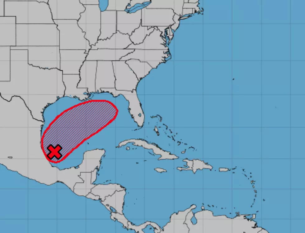
Forecasters with the National Hurricane Center have given the system, now much better organized, a 70% probability of becoming a tropical cyclone over the next few days. The center of the system is currently in the Bay of Campeche, or the southwest Gulf of Mexico.
Tropical weather models suggest the system will move to the north and northeast over the next few days. This would bring the system very close to the infamous "loop current" in the Gulf of Mexico. The "loop current" and the warm water it circulates through the Gulf have been instrumental in the rapid intensification of tropical systems in the past.
Whether that will happen with this system remains to be seen. The track forecast from the Hurricane center suggests the system will remain south of Louisiana's coastline as it moves across the Gulf. However, the system could be close enough to bring an increased threat of rain in the I-10 corridor, especially in southeastern Louisiana, this weekend.
Please remember these tropical model forecasts become less accurate through time. The system, because of its close proximity to our coast, will need to be monitored over the next several days in case there are changes to the forecast track.
More From 97.3 The Dawg


