How Much Rain From Harvey?
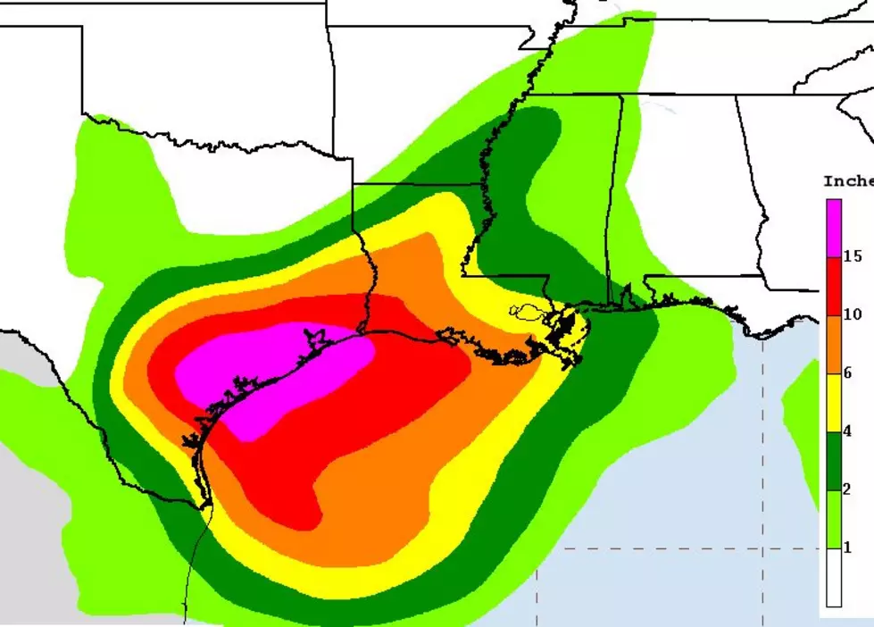
That is the question that has most people in South Louisiana on edge this morning and looking toward the weekend. The graphic you see above is from the National Hurricane Center. These rainfall projections are likely to change depending on the actual track that Harvey eventually takes.
The very basic prognostication is that the area along and west of a Lafayette to Alexandria line will likely see more than six inches of rain. This includes the towns of Crowley, Lake Arthur, Jennings, Iowa, Lake Charles, Oberlin, and Eunice. Keep in mind this is a very general forecast. Local amounts much higher than six inches of rain could very well occur.
Since the storm system is expected to create copious amounts of rainfall over the entire southern half of the state between Saturday and Wednesday if you live east of the line we've described you are far from being in the clear. As you can see on the graphic forecasters believe Baton Rouge and New Orleans will get their fair share of rainfall from Harvey too.
The latest forecast track on Harvey pushed the track of the system a little further away from South Louisiana but did suggest the system will strengthen and stall over the Texas coast. Some of the tropical models actually bring Harvey back out over the open water at the beginning of next week where it could bring even more rain to the area.
The bottom line is that you should anticipate the threat of flooding rainfall in South Louisiana. That threat will begin Saturday and last possibly through Wednesday. Please stay close to this station and this website for the latest official information.
More From 97.3 The Dawg


