Lafayette Weather – Rain Likely Today, Cooler Temps Tomorrow
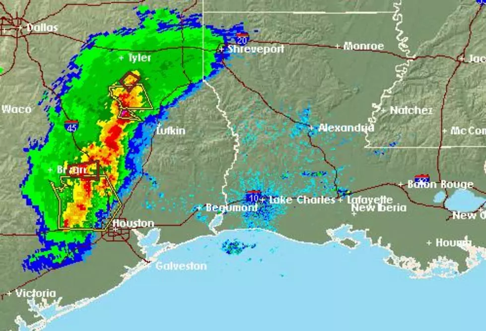
The combination of an upper level low pressure system and an approaching cold front will be the catalyst for precipitation across much of Acadiana today. The upper level system will push northeast out of Texas and bring with it moisture from the Gulf of Mexico. The current radar scan shows rain in the coastal waters and that precipitation should begin to move on shore after sunrise.
While the probability of rain is high for much of Acadiana today, the heaviest amounts will be along and east of a line from Cameron to Lafayette. Rainfall amounts should be anywhere from a quarter of an inch or less anywhere north and west of that line. While rainfall totals of half an inch are possible south and east of the line.
A strong cold front will approach the state late Tuesday. Since most of the available moisture will be pushed off to the east by the upper level low forecasters do not expect this system to bring a lot rain to the area. It will bring gusty northerly winds and cooler temperatures to Acadiana by midday Wednesday.
Daniel Phillips in the Storm Team 3 Weather lab is forecasting mostly sunny conditions for Wednesday and Thursday but temperatures will be quite cool. We should stay well above the freezing mark but with gusty breezes a jacket might be a good idea Wednesday and Thursday. The outlook for Patty in the Parc is calling for a mix of clouds and sun and a minimal chance of a passing shower.
More From 97.3 The Dawg