Tropical Storm Arthur Forms off East Coast
The 2020 Hurricane Season isn't even here officially yet tropical storm warnings have been posted for portions of the Outer Banks of North Carolina this morning. Those warnings were posted because the tropical preseason has it's first named storm.
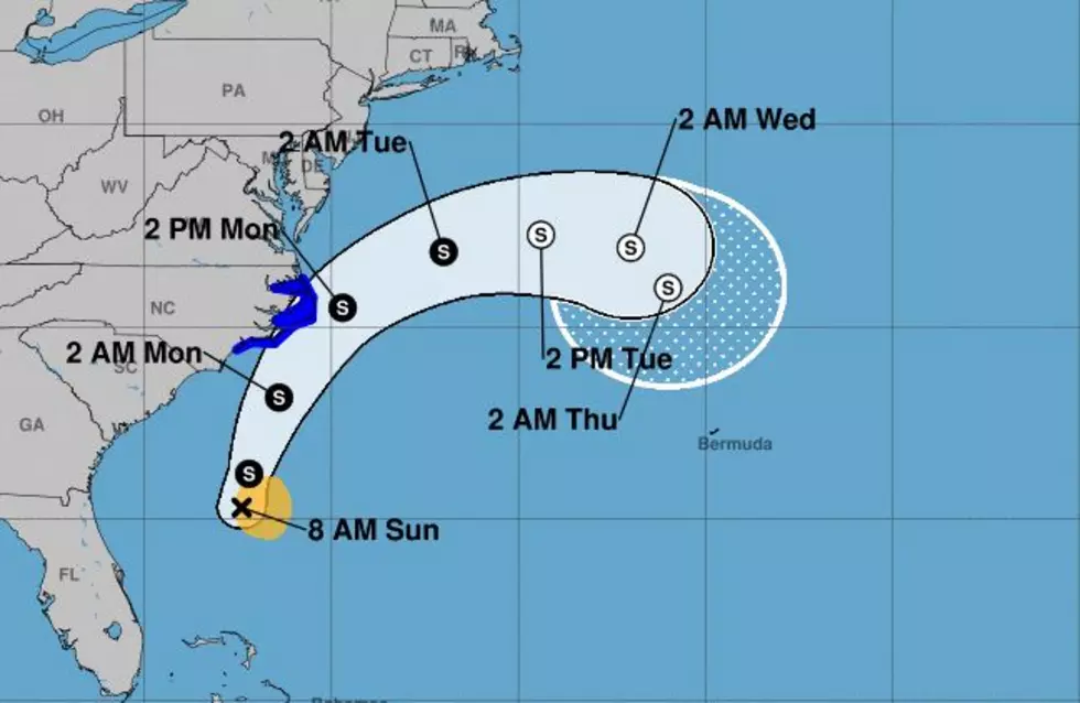
The system earned the name Arthur late Saturday is currently situated about 350 miles south-southwest of Cape Hatteras North Carolina. The storm has sustained winds of 40 mph. The system is moving in a north-northeasterly direction at 9 mph.
The current track forecast from the National Hurricane Center brings the center of circulation of Arthur very near North Carolina's Outer Banks later this evening and during the day on Monday. The greatest threat from Arthur appears to be in the form of heavy rainfall. However, it does appear as if most of the heavier showers will remain offshore or right along the coastline.
As of now, there are no other current tropical trouble spots in the Tropical Atlantic Basin. By the way, the official start of Hurricane Season isn't until June 1st. It's just one more way the year 2020 is really being a pain in the backside.
More From 97.3 The Dawg


