Watching Hurricane Irma
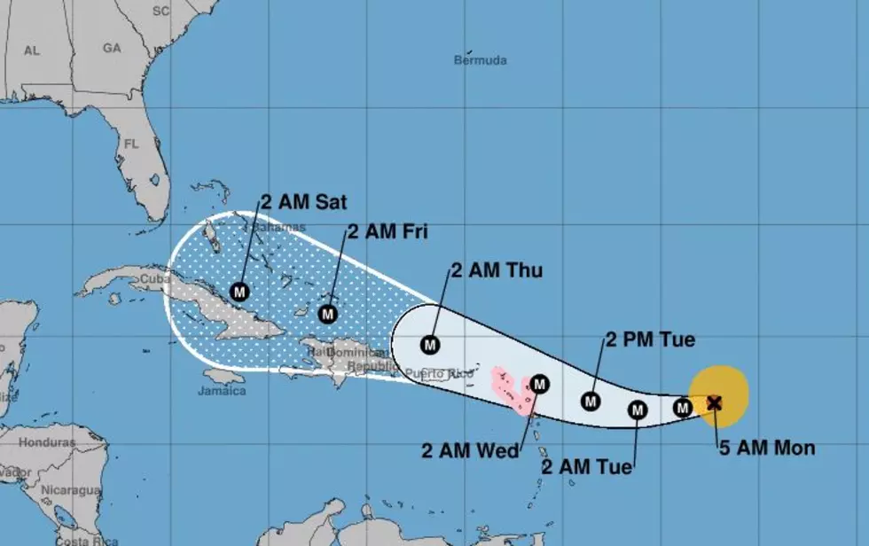
Hurricane Irma is a very dangerous storm. It's already a major hurricane according to the National Hurricane Center and has the potential to get even stronger. That's not so bad right now that the system is simply over open ocean. However, in the coming days, this storm will get closer to land masses that are inhabited.
The current forecast track from the Hurricane Center keeps Irma on a southwestward course for the next day or so. That track will become more true west after that time. This is where the forecast becomes more problematic for the Bahamas and the United States.
Long range tropical models lose accuracy the longer the forecast period. As of now the majority of the "spaghetti models" are tightly clustered together for the next four or five days. So the forecast confidence is pretty high. It is after that five day period that there appear to be more questions than answers.
Many of the models suggest Irma will make a turn to the right or toward the north but when and where that turn might occur is the big question. Unfortunately, only time will tell. What we do know is that this. We will be talking about Irma in a more urgent voice at this time next week when the system's impact on the United States will be in better focus.
More From 97.3 The Dawg


