
Weather Service – ‘Excessive Rainfall’ Forecast for Louisiana
The National Weather Service is suggesting to residents of Louisiana from Lake Charles to New Orleans and Shreveport to Vidalia and the parishes in between to get ready for an old-fashioned summer soaker. Oddly enough this increased threat of flooding rainfall can't be solely pinned on Hurricane Beryl. However, that tropical system will play a part in Louisiana's wet weather forecast as we move into next week.
Click here for the latest track information on Hurricane Beryl. But Beryl isn't to blame for the increased threat of showers and storms that Louisiana will likely experience this afternoon and throughout the remainder of the holiday weekend. The catalyst for those showers and storms will be a frontal boundary that is draped across the northern third of the state.
The proximity of that frontal boundary coupled with daytime heating and abundant humidity will kick off showers and storms across Louisiana again today. The National Weather Service Forecast Office in Shreveport has rain chances in northwest Louisiana at 60% for this afternoon. That is similar to what NWS forecasters have predicted for south Louisiana. Rain chances will again be high on Saturday.
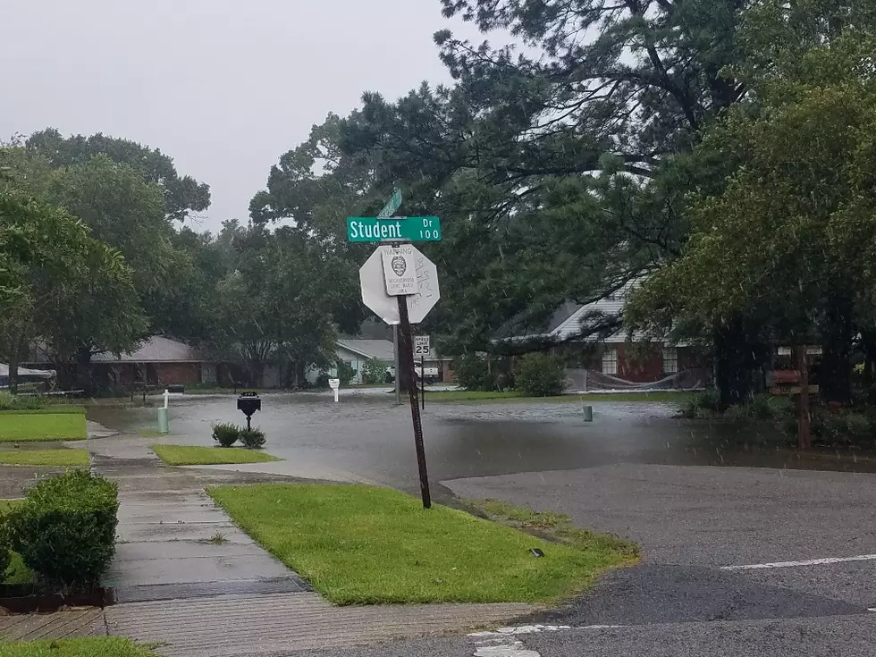
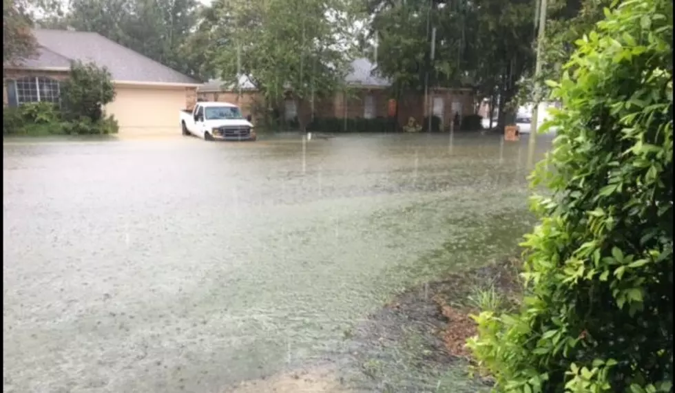
For that reason, the Weather Prediction Center has placed almost all of Louisiana at a marginal risk for an excessive rainfall event. "Excessive Rainfall" is defined by the National Weather Service as a rainfall rate that exceeds a given area's ability to drain. In other words, rainfall rates exceed drainage rates, and that usually leads to some street flooding and ponding of water in low-lying areas.
As of now, a similar threat will be in place for Louisiana on Sunday. Then we have to start figuring out how the moisture from Hurricane Beryl will figure into the forecast. Some of the tropical models push Beryl deeper into Texas and Mexico while others have the storm turning more northerly and moving into the Texas Hill Country.
Should the "Hill Country Scenario" be the one that unfolds, and that is the scenario the National Hurricane Center is going with, that could mean excessive rains for southeast Texas and much of Louisiana during the early part of next week. Some forecast models showed rainfall amounts of up to seven inches from showers and storms over the next seven days.
Naturally, the forecast will be fine-tuned over time and by Monday we should have a much better idea of just how Beryl will or won't affect Louisiana's weather moving forward. If there is a silver lining in all of these clouds, at least there aren't heat advisories posted for the next few days. So, we do have that going for us.
11 Odd Things People Say When They Find Out You're From Louisiana
Gallery Credit: Bruce Mikells
More From 97.3 The Dawg


![Beryl Tracking Toward the Gulf As a Category 5 Hurricane [Update]](http://townsquare.media/site/33/files/2020/09/Palm-Trees-in-Hurricane-Earth-Uncut-TV-via-YouTube.jpg?w=980&q=75)
