Hurricane Danny A Little Stronger This Morning
As hurricanes go, Hurricane Danny is a very small storm. The area covered by the storm is considerably less than the iconic Hurricanes Katrina and Rita of 2005. Still Danny will be a force to be reckoned with at least for the next several days.
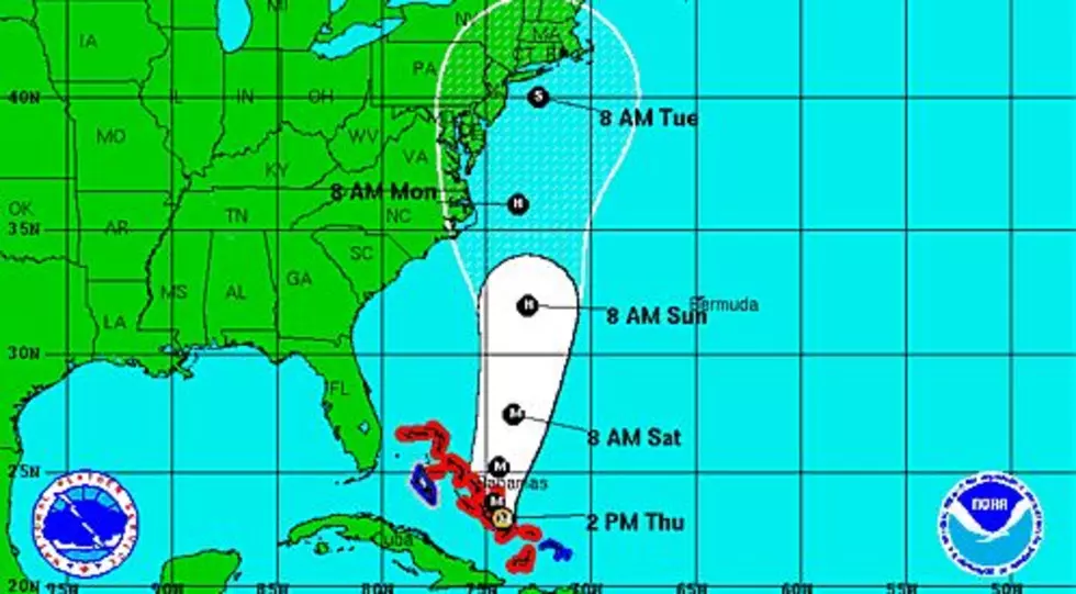
Over night the system gained just a little big in strength and wind speed. At the 4am advisory the top sustained winds of the storm were reported to be 85 mph making the storm a Category 1 system on the Saffir-Simpson scale.
Danny is currently in a favorable environment for getting stronger and that's what forecasters at the National Hurricane Center believe will happen over the next 12-24 hour period. After that time frame Danny will move into an area of higher wind shear and drier air. Both of those factors will likely inhibit the storm from growing stronger.
Many of the intensity models forecast Danny to drop below hurricane strength by Sunday morning. The track forecast models keep Danny on a west northwest track for the next several days. Based on that track the system should enter the northern Caribbean Sea by Monday morning. Depending on the exact track, possible interaction with land will determine whether Danny will survive the trip over the mountains of Puerto Rico and Hispanola.
Forecasters are still uncertain as to whether or not Danny will become a factor in the Gulf of Mexico. If it does we will certainly have a much better idea of that by early next week.
More From 97.3 The Dawg