Forecasters Now Watching Eastern Gulf For Tropical Development
The 2019 Hurricane Season was forecast to be "about average". By average, that means a range of nine to fifteen named storms in the Atlantic Basin between June 1st and November 30th.
We've just gotten our 8th named storm of the season with Humberto. Plus, there are four other areas of concern that are being monitored at this time.
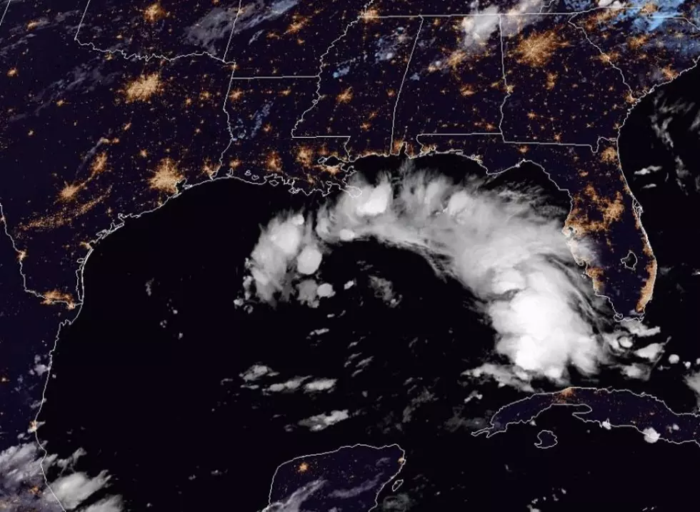
The area of disturbed weather that would be of greatest concern to the northern Gulf coast would be currently located off the west coast of Florida. That system is poorly organized at this time so any development would be slow.
In fact, the National Hurricane Center is only giving the system a 20% probability of strengthening into a tropical cyclone over the next five days.
While the "threat" from this system at this time is very low it is worth watching. Forecast models suggest the system will slide across the Gulf toward the Texas coast. Which could bring convection associated with the system into Louisiana by late next week. Obviously, this forecast scenario will change, perhaps significantly, over the next five days.
The other three areas of tropical concern are in the open waters of the Atlantic. Two of those systems are given a 20% probability of strengthening while the area of concern that is furthest to the east has been given a 60% probability to intensify into a tropical cyclone.
As the closest of these systems is still over 1000 miles away from any inhabited landmass there is still plenty of time to watch and wait.
More From 97.3 The Dawg


