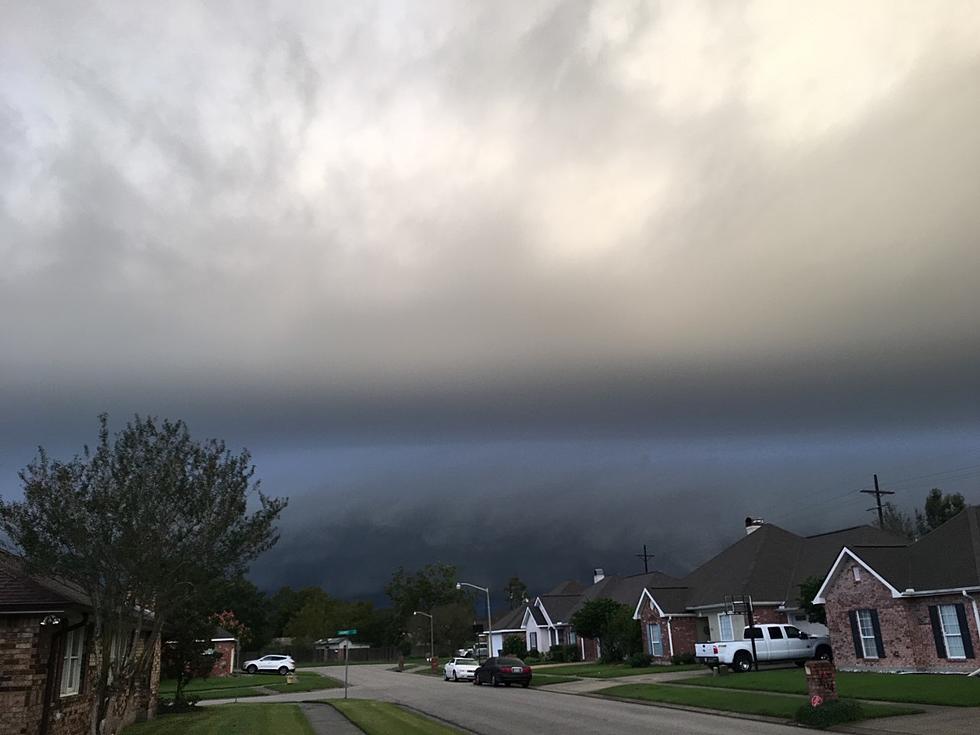
Funnel Cloud Sighted in South Louisiana Friday
(KMDL-FM) The past few days along Louisiana's I-10 corridor from Lake Charles, through Crowley, Lafayette, Breaux Bridge, and on to Baton Rouge and New Orleans have been bumpy to say the least. Bumpy and wet would be more accurate if you wanted more adjectives.
I-10 isn't as scary when you can't see what's on the road, right? Wrong, we've still got a few more downpours to deal with on Friday afternoon. In addition to heavy downpours, there are other threats you should be aware of across southwestern Louisiana.
Based on what forecasters with the National Weather Service are telling us, that weather trend of torrential downpours and thunderstorms is coming to an end this afternoon and evening across the state. However, Mother Nature is not going to let our Memorial Day week of storms end without a bang.
READ MORE: Louisiana's New Window Tint Law: Will You Still Be Legal?
READ MORE: Best Bait For Catching Bears in Louisiana
A late spring cold front is currently pushing across the southeastern United States. If you view radar scans from the Eastern Seaboard and the Appalachian Mountains, you can see the front is packing quite a punch up there. There are severe thunderstorm watches, warnings, and tornado advisories posted for many counties from the Carolinas through Virginia and West Virginia.
Where Were Funnel Clouds Sighted in South Louisiana on Friday?
Meanwhile, closer to home, along the Gulf Coast, the atmospheric conditions have not been quite so volatile. Although just before 2 pm, a strong thunderstorm rumbled through portions of Lafayette. The current scan from the Lake Charles radar shows where the current storms are located.
As we mentioned, some thunderstorms moving across the area are quite strong. In fact, the National Weather Service Forecast Office in Lake Charles issued a special weather statement regarding tropical funnel clouds.
Special Weather Statement for South Louisiana - National Weather Service
Here's a portion of that advisory,
A very moist and unstable tropical airmass is in place across the area. Meanwhile...the vertical wind profile over the area is light and variable. These conditions are favorable for the development of tropical funnel clouds...especially where rain cooled boundaries...\known as outflow boundaries...and the seabreeze collide.
Are There Tornado Watches Posted for Louisiana This Afternoon?
One such funnel cloud was confirmed near Sabine Lake on the Louisiana-Texas line. The advisory did explain that, for the most part, these tropical funnel clouds are short-lived and usually pose no threat as they stay above ground. However, some of the funnels do reach the ground as tornadoes, and minor damage is a possibility.
Over the course of Friday afternoon, most of the showers and thunderstorms should move out of southern Louisiana. The forecast calls for improving conditions with lower humidities during the nighttime Friday night and during the day on Saturday. Skies will be sunny and temperatures will be warm. An afternoon high of 84 is expected along much of the I-10 corridor.
12 Unpopular Opinions in Louisiana That Really Are the Truth
Gallery Credit: Bruce Mikells
More From 97.3 The Dawg


