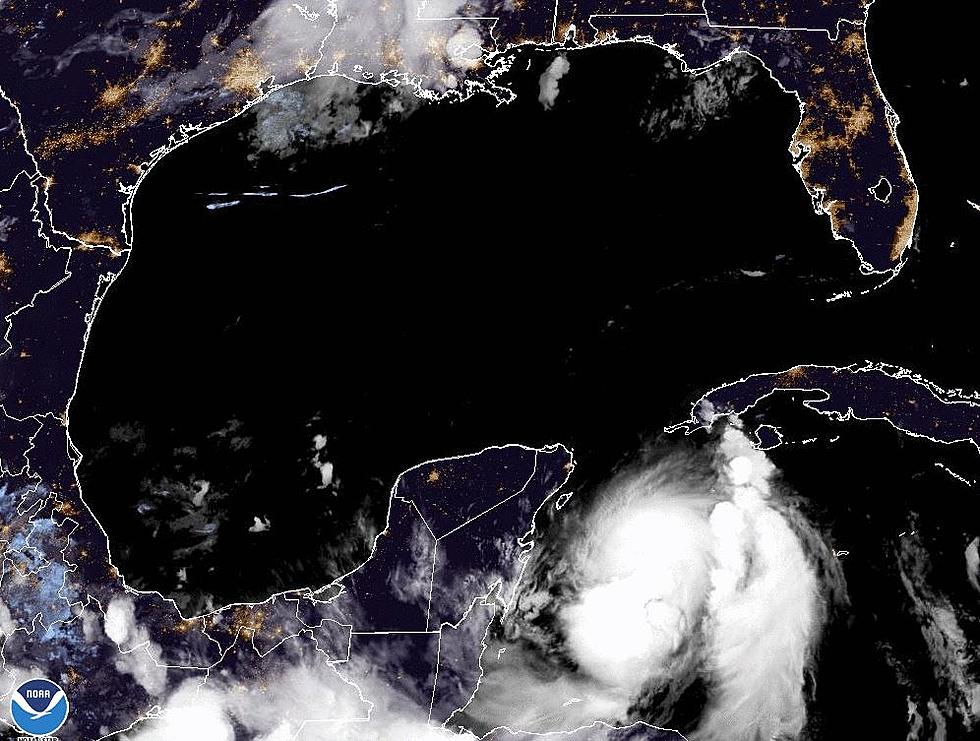
Hurricane Ida – What You Need to Know About the Storm
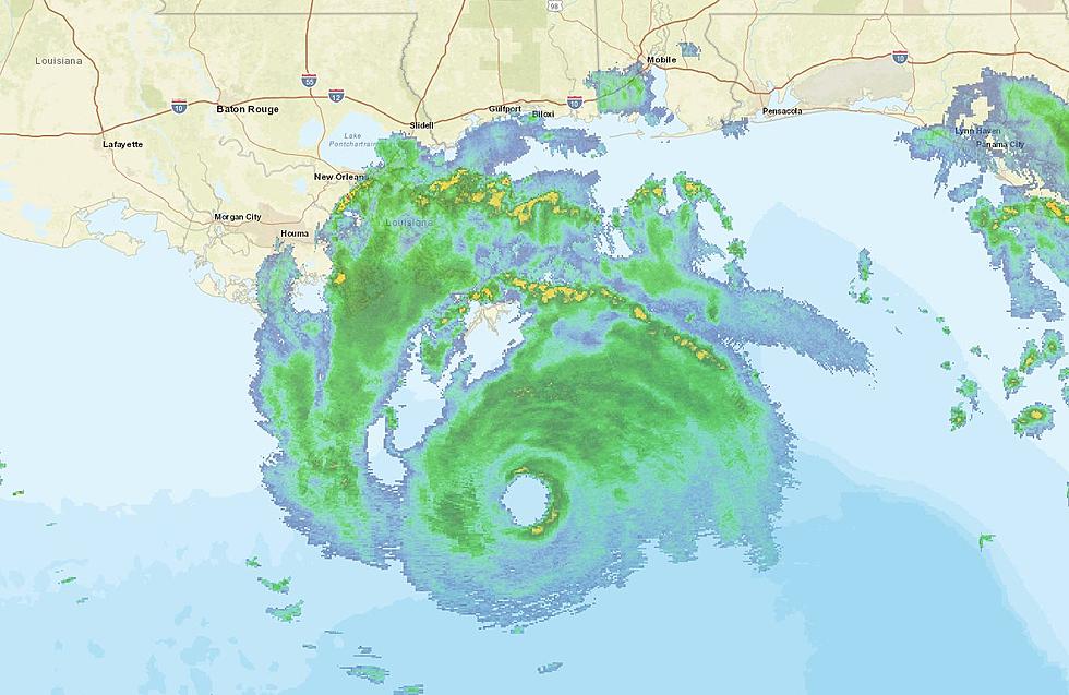
The image you see above is from the National Weather Service Radar site that serves the New Orleans area. For a live look at that radar, click here. Meanwhile, the National Hurricane Center has issued their 0400 CDT Advisory:
...DANGEROUS CATEGORY 4 HURRICANE IDA STRENGTHENS SOME MORE...
...LIFE-THREATENING STORM SURGE, POTENTIALLY CATASTROPHIC WIND
DAMAGE, AND FLOODING RAINFALL WILL IMPACT PORTIONS OF THE NORTHERN
GULF COAST BEGINNING LATER THIS MORNING...


SUMMARY OF 400 AM CDT...0900 UTC...INFORMATION
----------------------------------------------
LOCATION...28.0N 89.1W
ABOUT 75 MI...120 KM S OF THE MOUTH OF THE MISSISSIPPI RIVER
ABOUT 145 MI...235 KM SE OF HOUMA LOUISIANA
MAXIMUM SUSTAINED WINDS...140 MPH...220 KM/H
PRESENT MOVEMENT...NW OR 315 DEGREES AT 15 MPH...24 KM/H
MINIMUM CENTRAL PRESSURE...946 MB...27.94 INCHES
Shortly after 2, this morning hurricane hunters found that winds near the eye of Hurricane Ida had reached 130 miles per hour, which makes the storm a category 4 o the Saffir-Simpson hurricane scale. The track of the storm should bring the center of circulation onshore across southeastern Louisiana later this morning. The projected path suggests a landfall between Houma and Grand Isle
At 400 am the center of the storm was about 75miles south of the mouth of the Mississippi River or 145 miles southeast of Houma. The storm was moving to the northwest at 16 mph and the system is expected to stay on that track thru landfall.
Forecasters say the storm will weaken rapidly once it makes landfall but will still be a very dangerous hurricane as it moves between Houma and New Orleans later this afternoon and just east of Baton Rouge during the nighttime hours. It should be noted that Ida will likely be a category 1 storm as approaches the Baton Rouge metropolitan area early Monday morning.
The marker on the map below is the forecast position of the storm's center of circulation about 0400 CDT Monday morning. Please note, that position is subject to change.
Outer bands from Ida are already onshore in southeastern Louisiana, those bands will be spreading westward across the southern third of the state throughout the day and into the evening hours.
These rainbands are expected to create flash flooding across many parts of the state. Even areas well away from the center of circulation could be inundated with tropical downpours between now and Monday evening.
As far as Acadiana is concerned, winds gusting to tropical storm force or above will be likely across eastern Acadiana and the Atchafalaya Basin. Rainfall amounts of four to six inches will not be uncommon for those areas. Meanwhile, westerns sections of Acadiana will be quite breezy with passing tropical showers and storms throughout the day, some of those downpours could be heavy. One to two inches of rain will not be uncommon over the next 24 to 36 hours.
The next advisory from the Hurricane Center is scheduled for 7 am with a complete update including an updated track forecast will come at 10 am.
Hurricane Ida certainly is our prime area of concern this morning but we do need to let you know that there are four other areas of concern in the tropical Atlantic Basin at this time. Those areas include two tropical depressions and two other areas of disturbed weather.
Both tropical depressions are in the Mid-Atlantic Ocean and should pose no threat to any landmass at this time. There is an area of disturbed weather off the coast of Maryland. That system is expected to drift toward the southeast in the general direction of Bermuda. Forecasters give this system a slight chance of strengthening over the next five days.
The other area of concern is a tropical wave that has yet to roll off the African Continent. That wave is given a 70% chance of becoming a tropical cyclone by the end of the week. It should pose no threat to any landmass over that time frame but will bear watching through time.
Orkin's Top Cities for Mosquitos in 2021 Includes Lafayette
More From 97.3 The Dawg


