
Some Tropical Models Bring Dorian Into The Gulf Over Labor Day
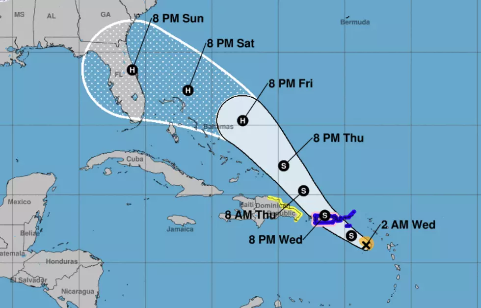
There are two tropical storms in the Atlantic Basin this morning. Tropical Storm Erin received that designation yesterday while spinning just off the east coast of the United States. Meanwhile, in the Caribbean, Tropical Storm Dorian is bearing down on the island of Puerto Rico.
Oddly enough the system that is the closest to the U.S. mainland appears to be the least of our worries. Erin, located about halfway between South Carolina and Bermuda is on a projected track that would take the system out to sea over the next several days. This would make Erin an issue with shipping concerns and not so much of a concern for the coast.
Tropical Storm Dorian, that's a different storm and a different prognostication all together. The official forecast track from the National Hurricane Center does bring Dorian onshore along the Florida Coast near Cape Canaveral late in the day on Sunday.
Should that forecast hold Dorian would likely cross the coast as a category 1 hurricane. The problem with the forecast is that by the time Dorian makes landfall it will be heading in a westward direction. That movement would carry the storm across the 150 miles of the Florida Peninsula and into the very warm waters of the Gulf of Mexico by late in the day on Labor Day.
While there is no huge model consensus that would lead us to believe Dorian will become a threat to Louisiana's coastline there is enough uncertainty in the model solutions that it is certainly worth mentioning even five to seven days out. Naturally, we will simply have to wait and watch to see what path the storm system will take over the next few days.
More From 97.3 The Dawg


