
Storm Damage Reported in Louisiana Overnight
Mother Nature has not been kind to Louisiana over the past several weeks. It seems as if our state has suffered severe weather watches, warnings, and damage, during the middle of the week each week for at least the last month.
The nighttime hours of Tuesday into the early morning hours of Wednesday have revealed some of the damage that portions of the state have already received and the rest of the state could realize as storms march through later today.
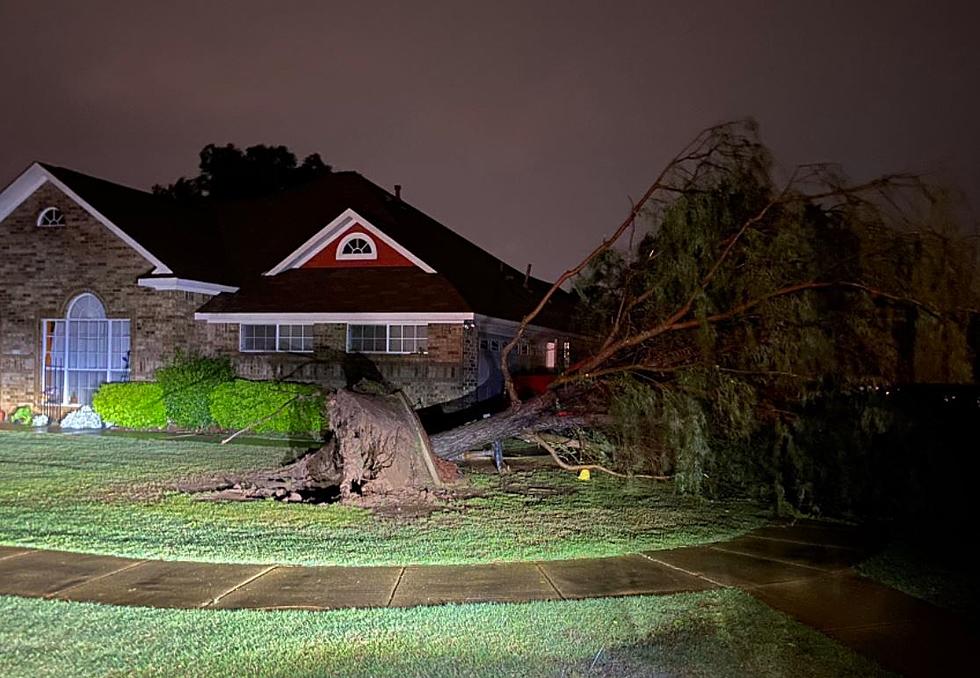
As of 0200 AM, there are severe weather watches and warnings posted for much of northern Louisiana. The pictures you see above are from the Shreveport/Bossier City area. That area continues to be pummeled with strong storms even as we write this article.
As of 0200, this is what the National Weather Service Radar was showing as far as showers and thunderstorms across the state.

The good news for residents along and south of Interstate 10 is that this area of showers and storms is decreasing in intensity and is actually moving to the east. If that direction holds, the majority of these storms will remain north of the cities of Lake Charles, Lafayette, and Baton Rouge.
That doesn't mean those cities aren't out of the woods as far as severe weather is concerned. The Storm Prediction Center has placed much of South Louisiana under a slight risk for severe storms today. The threat of severe storms is enhanced for much of northeastern Louisiana with an even greater threat of severe storms across the Mississippi Delta and western Tennessee.

As far as what we can expect from Mother Nature today, the morning hours along the I-10 corridor in Louisiana should be rather calm. It will be quite windy though as southerly breezes are expected to blow from 15 to 20 mph with gusts as high as 30 mph. Showers and storms aren't expected to fire up in the area until later this afternoon when rain chances will be near 70%.
Showers and storms will remain likely in the area for most of the evening hours. Forecasters have it listed as 80%. The majority of the showers and storms should move through the area by midnight or shortly thereafter.
Thursday should be a sunny day across South Louisiana with a threat of showers returning during the nighttime hours. The forecast for Good Friday calls for a mix of clouds and sun and a 30% chance of showers. Easter Sunday should be partly cloudy with a 20%-30% chance of showers.
LOOK: The most expensive weather and climate disasters in recent decades
Gallery Credit: KATELYN LEBOFF
More From 97.3 The Dawg


