Tropical Development In The Gulf Likely By The Weekend
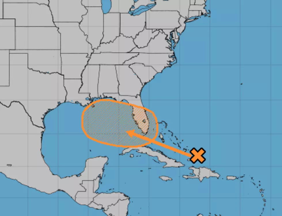
Forecasters with the National Hurricane Center have upped the probability of an area of disturbed weather becoming a tropical cyclone in the Gulf of Mexico within the next five days. The most recent Hurricane Center tropical outlook suggests that the area of disturbed weather now over the Bahamas will have a 50% probability of becoming a tropical cyclone in the Gulf of Mexico by sometime Sunday.
Forecasters say the area of showers and thunderstorms associated with a surface trough of low pressure will move through the Florida Straits and into the Gulf by Friday. That's where atmospheric conditions and warm water temperatures are more conducive for tropical development.
The system identified as Invest95L by the Hurricane Center is now being picked up by some of the more reliable tropical forecast models. As of early this morning, the models showed a general consensus on the track guidance at least into the eastern Gulf of Mexico.
The models begin to disagree the further the forecast is carried out through time. Some of the model guidance suggests the system will impact the area around Panama City Florida. Other model solutions bring the storm system further to the west toward coastal Mississippi or even extreme southeastern Louisiana.
Regardless, we will need to keep a watchful eye on the movement and strength of this particular system, especially if it gets into the Gulf of Mexico. How the rest of the story unfolds we will likely find out next week.
More From 97.3 The Dawg


