Tropical System Catalyst For Very Wet Weekend
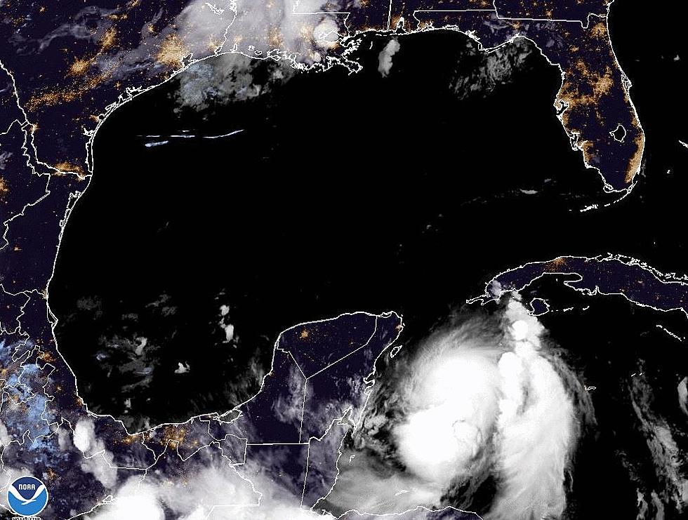
Forecasters with the National Hurricane Center are certain that later today or tonight there will be a tropical depression or possibly the return of Tropical Storm Harvey in the Gulf of Mexico. The forecast track of this system is the bigger question mark this morning.
Guidance from the Hurricane Center based on tropical forecast models continues to bring what would be the center of the broad area of circulation associated with the system further north. The current best guess scenario would put the center of whatever the system strengthens to be on shore along the middle Texas coast late Friday.
For South Louisiana, this is shaping up to be a major rain event for the weekend and into early next week. The current National Weather Service forecast for the area has at least a 60% probability of rain and thunderstorms beginning Friday and lasting at least through Monday.
It is very likely that rainfall totals over the area will prompt some flood watches, warnings, and advisories over the next several days. Forecasters believe that as the system nears the coast it will slow down its forward motion and will be slow to leave the area. This plus the abundant moisture associated with the system will mean a persistent threat of flooding rain for the area.
More From 97.3 The Dawg


