Watching the Gulf for Tropical Development
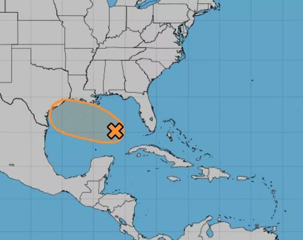
An area of disturbed weather that forecasters with the National Hurricane Center have been monitoring since this past weekend is slowly spinning its way across the Gulf of Mexico this morning. This system will likely be a catalyst for more rain and thunderstorms across South Louisiana over the next few days as it moves slowly toward the middle Texas coast.
Hurricane Center forecasters still do not give the system much of a chance to strengthen, although the system is moving through an area of the Gulf where that could happen. Right now the probability of the tropical wave becoming a tropical cyclone is about 40% over the next five days.
However, by tomorrow and Friday, the expected proximity of the system to Louisiana's coastline will likely increase the threat of rain and thunderstorms across the area. Most of the track guidance from tropical models keep the system south of Louisiana with an anticipated landfall somewhere in Texas later this week.
Meanwhile, further out in the Atlantic Tropical Depression Seven has formed. Should this system strengthen it would be given the name Gonzalo if it is designated as a tropical storm, which is expected to be later today.
The track of that system will bring it into the eastern Caribbean Sea over the next few days. Beyond that time frame, any suggestion of a potential track or strengthening would simply be conjecture. So, we'll just have to wait and see on that system.
Cheers To These Summer Cocktails In Lafayette
More From 97.3 The Dawg


