Hurricane Center Tracking Three Trouble Spots – One in the Gulf
The National Hurricane Center is tracking three potential tropical trouble spots, including one in the Gulf of Mexico this morning. How these systems will affect Louisiana's weather is not exactly certain at this time.
The good news is that two of the three systems are only given minimal chances of strengthening at this time. Two of the three are also well away from the Louisiana coastline, too. But no matter what the forecast or the location or the possible track it would serve you well to be aware of what's going on with these weather systems over the next several weeks.
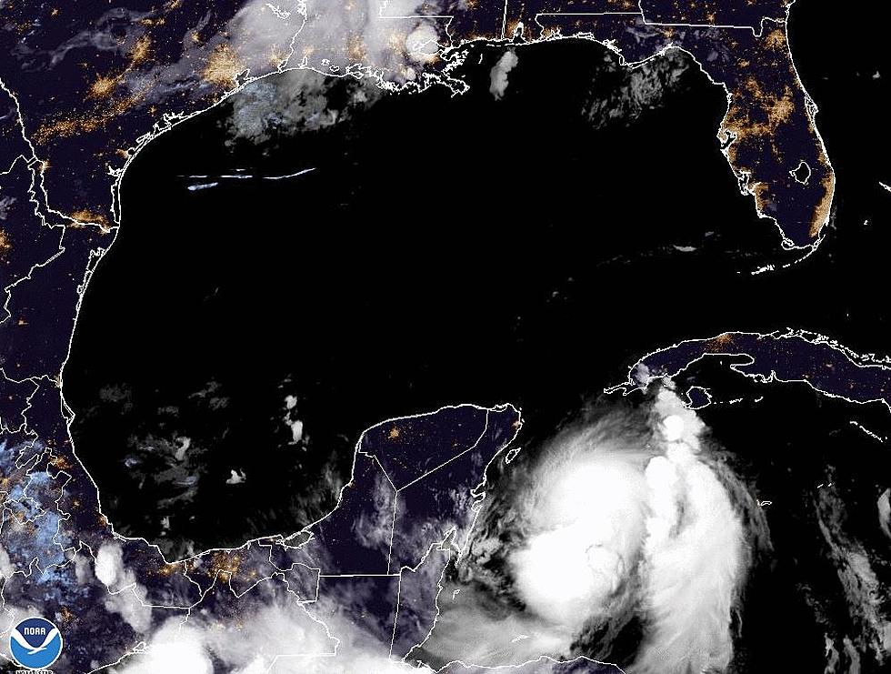
The strongest of the three systems is a tropical wave that we have been monitoring since last week. It is in the lower latitudes of the mid-Atlantic Ocean. The forecast track for this system suggests it will stay well south of the Gulf of Mexico. In fact, it might actually brush the coastline of Venezuala before making a final landfall along the coast of Nicaragua this weekend.
Forecasters are giving this system a 90% probability of becoming a tropical cyclone over the next two days. Should that system earn a name, it would be the season's second named storm and would earn the moniker Bonnie.
The closest of the three systems to Louisiana is compromised of a low-pressure trough that is centered just off the southeastern Louisiana coastline. This system is only given a 20% chance of strengthening into a tropical cyclone by the end of the week.
The track forecast suggests the system will be pushed to the south and west by a strong high-pressure system centered over the Carolinas and bolstered by another high pressure centered over south-central Texas. By this weekend that trough of low-pressure should be close to Corpus Christi Texas or even further to the south.
Louisiana is already feeling the effects of this system and a weak frontal system with an increase in Gulf moisture. That's the reason for the increased threat of rain and thunderstorms across the area for the balance of the workweek.
The good news is that rain and clouds will keep temperatures down compared to the record-breaking heat we've seen the past few weeks. It should also help ease drought conditions in southern Louisiana as well.
The third system which forecasters describe as "disorganized showers and thunderstorms" is well out in the Atlantic near the Cabo Verde Islands. The Hurricane Center is only giving this system a 20% probability of becoming a tropical cyclone over the next five days.
However, we don't need to sleep on this system. Should it hold together it will be moving over the very warm waters of the Caribbean Sea and that could be a catalyst for development down the road.
Again, there is nothing imminent with either of these systems, other than the enhanced rain and thunderstorm chances we've described earlier. We do encourage you to check back with us often as conditions in the tropics and tropical forecasts change quite frequently.
In the near term, we do hope you remember how to drive in the rain, it's been a while since we've had to do that along the I-10 corridor. And while you're driving, make sure you mind the posted speeds.
South Louisiana's Most Infamous Speed Traps
More From 97.3 The Dawg


