Hurricane Hunter Aircraft To Fly Into Gulf System Today
One of the most often asked questions about the current tropical scenario unfolding in the northern Gulf of Mexico this morning is this, "Where's that thing going to go"? True, that is the $64 Dollar Question but arriving at an answer is never easy for forecasters.
Today, "Hurricane Hunter" aircraft are scheduled to fly into the area of disturbed weather and hopefully gather more specific information on the system and its potential for development. The data collected from these flights will be scrutinized by National Hurricane Center meteorologists and from there we should have a better idea of what this storm system could become and where it might heading.
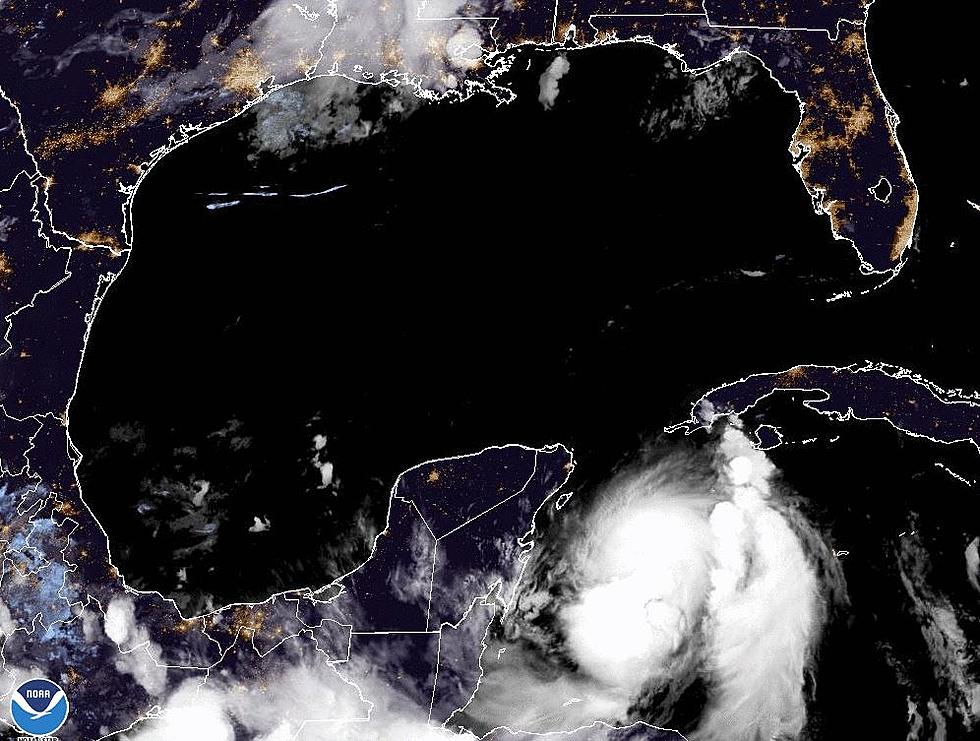
As of early this morning ( 1 AM CDT), there had been very little change in the status of the system. Late yesterday the center of the system's very broad area of circulation moved off the coast of Florida and into the very warm waters of the northern Gulf.
Forecasters believe the system will strengthen over those warm waters over the next several days. However, this morning the system was nothing more than a very disorganized area of showers and thunderstorms.
Tropical forecast models have shifted the forecast track a little eastward since yesterday's model runs. Many of the reliable tropical models are now suggesting the system will reach tropical storm status perhaps by Thursday and approach the Louisiana coastline by late Friday.
A consensus of many models seems to suggest the strengthening storm system will move toward the southeast Louisiana coastline and then make a more northerly turn. Where and when that northerly turn happens will be the determining factor of how bad the weather will get in our area.
Based on this guidance much of Acadiana would be on the western side of the system. That would be good news for us since most of the heavier weather and heavier rainfall will likely occur on the eastern side of the storm's circulation.
This doesn't mean you shouldn't continue with your preliminary preparations for an approaching storm. These model track runs can change drastically over a short period of time. You should only use official forecast information when making your decisions about life and property.
More From 97.3 The Dawg


