Lake Charles Weather Radar Almost Ready for Service
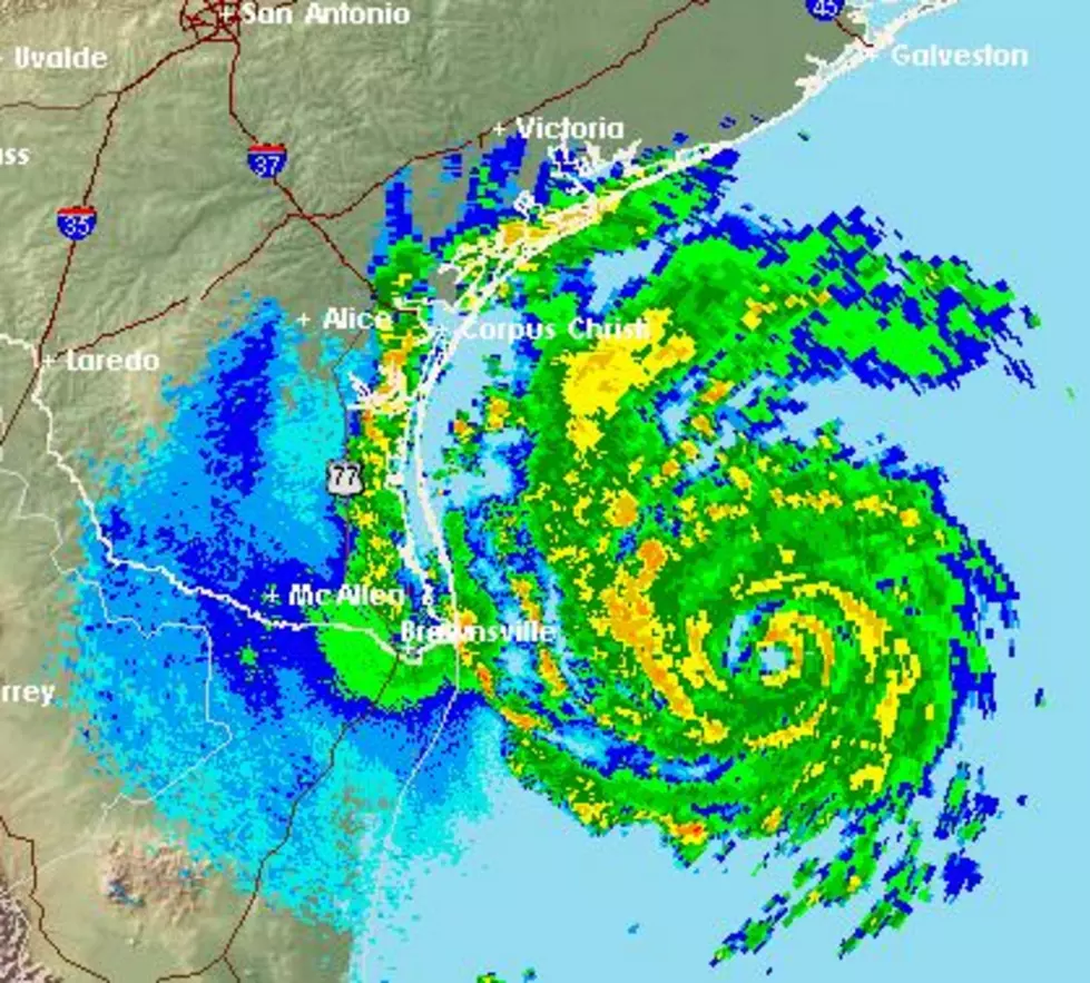
There are very few times in the life of a piece of technology that we can actually pinpoint the moment it failed. In the case of the Doppler Radar at the National Weather Service Office in Lake Charles, that moment is forever frozen in time. The radar scan shows the eye of dangerous Hurricane Laura approaching the coast of Louisiana.
At that moment the winds of the storm literally tore the radar site apart. In the most post-Hurricane Laura and Hurricane Delta too meteorologists with the National Weather Service Office in Lake Charles have been working to get their new radar system installed, fine-tuned, and ready for work.
As of this weekend, in fact maybe as soon as today, all that work could culminate in the bringing of the Lake Charles radar site back online. The new radar is currently being tested and should all systems check out forecasters could have an important tool back in their tool chest when it comes to keeping residents of south Louisiana safe from Mother Nature's storms.
Although severe weather can happen at any time, the winter months of January and February are not notorious for severe weather in our part of the country. However, when we flip the calendar over into March, that's when things start to get a bit dicey with springtime thunderstorms and potential tornadoes.
Granted today and through the weekend the area along and south of I-10 will have a threat of showers and storms they are not expected to reach severe limits, at least according to forecasters with the Storm Prediction Center.
Most of the area will receive an inch of rain or less in showers and storms that pass over the area between now and Saturday. However, the outlook for the new work week does hold a threat of more inclement weather and showers.
Most Underrated Restaurants in Acadiana
More From 97.3 The Dawg

![NWS Releases 2020 Hurricane Season Animated Infrared Satellite Imagery [Video]](http://townsquare.media/site/33/files/2020/12/2020-Hurricane-Season.jpg?w=980&q=75)