Peak of Hurricane Season Brings Troublesome Forecast for the Gulf
This is it. We have made it to the top of the mountain. Unfortunately, it's not a mountain that anyone in the Gulf South wants to climb. The mythical "mountain" we speak of is the peak of the Atlantic Hurricane Season.
After today, technically the rest of the season is all downhill. But those who have logged more than one hurricane season along the Gulf Coast know that the downhill run can be just as treacherous as the climb to the top.
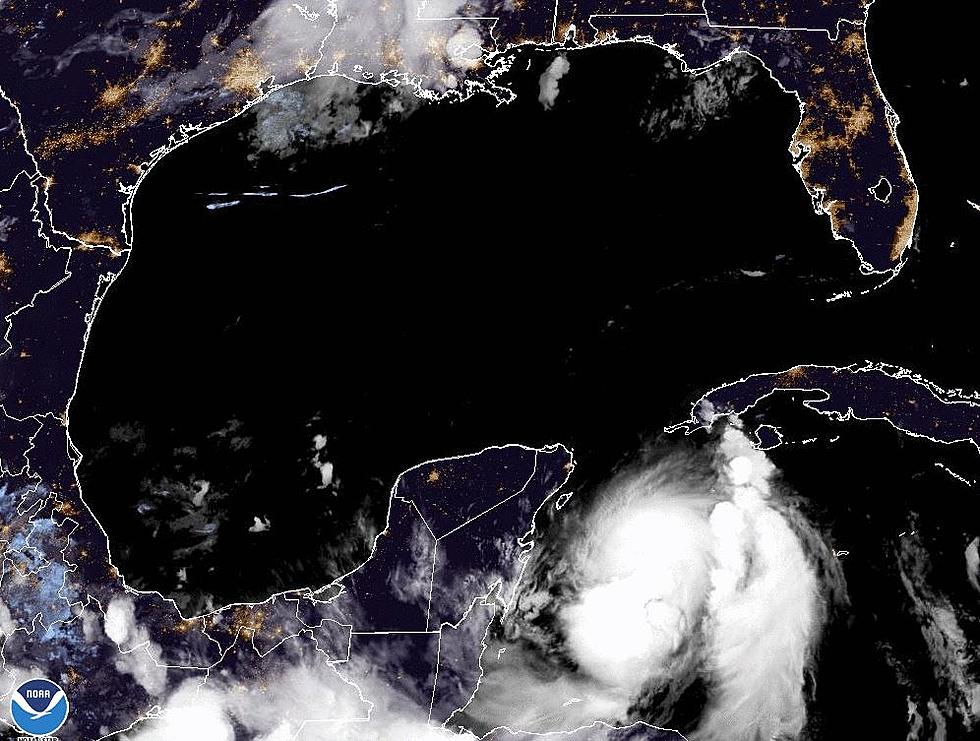
In fact, the National Hurricane Center has upped the probability of a tropical cyclone forming in the Gulf of Mexico sometime next week. The tropical wave in question is currently nestled very close to the shore of Honduras on the Caribbean side of the Central American isthmus.
Forecasters believe the system will track north and west crossing Belize and the Yucatan Peninsula over the weekend. Should the system remain intact it would emerge into the very warm waters of the Bay of Campeche or the southwestern Gulf of Mexico.
Hurricane Center forecasters are giving the system a 60% probability of strengthening into a tropical cyclone. By that, we mean a tropical depression, tropical storm, or hurricane.
As of now, the Hurricane Center's forecast track suggests the system will track right along or just east of the east coast of Mexico as it moves to the northwest. Based on this track extreme south Texas could feel impacts from the system by early next week.
However, we all want to know what's the best guess on where the system will go should it not make a Mexican landfall or cross the coast in South Texas. For those "best guesses" we consulted the GFS Model. The 0000Z run of the GFS suggested the system would grow stronger and move into southern Texas.
However, in that scenario, there would still be an abundance of moisture pushed into the upper Texas coast and southwestern Louisiana next week. This could mean tropical rains and downpours. But remember, this is a model and not an official forecast. Don't make any decisions based on just one model run.
The 0000Z model run of the European Model did not suggest such a robust system developing at all. Hence, the reason we don't react to model forecasts. However, that model run did suggest that a lot of moisture would be connected with this system.
But you should be thinking about the possibility of at least some very heavy tropical rains beginning early next week. Meteorologist Rob Perillo in a post on the KATC Television website showed some rainfall potential statistics which would be very alarming if they came to fruition. So, we'll need to watch the forecast very closely as we move into Monday.
In the short term, today and Saturday should be wonderful. A cold front pushed through the area yesterday and temperatures and humidity are much lower this morning. Skies should be sunny today and Saturday but rain chances do creep back into the forecast for Sunday.
Fun Day Trips Close to Acadiana
More From 97.3 The Dawg


