Severe Weather Watches Posted for Acadiana This Morning
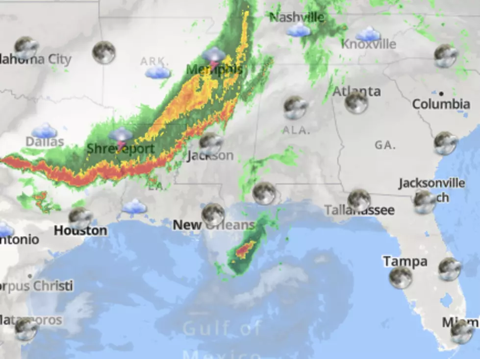
The National Weather Service has posted a Severe Thunderstorm Watch for much of Acadiana this morning. The watch area includes a large section of the state including Lafayette, Baton Rouge, and Lake Charles. Judging by what we are seeing on the weather radar scan out of Lake Charles, I can see why we are under that watch.
During the overnight hours, a line of strong storms has tracked southeastward out of east Texas and into Louisiana. The line of storms is moving at about 45 mph which is pretty fast as far as thunderstorms are concerned.
The image you see above was taken at about 3 am. So, if you're looking at this at a later time, it's a safe bet this line of storms has moved a lot. Here's the current scan from KATC.
During the evening this line of storms has been responsible for wind gusts in excess of 60 mph and even some small hail. Based on observations and timing the leading edge of this large line of strong storms should begin to affect the northern sections of Acadiana as early as 5 am.
The system should rapidly push through the area later this morning. Behind this weather system, conditions are much calmer. The worst of the area should be exiting Acadiana before 9 this morning. That will leave much of Acadiana covered in clouds for the next several hours.
Forecasters do anticipate some clearing by later this afternoon. The forecast moving forward for the rest of the workweek into the weekend is calling for mostly sunny skies and seasonable temperatures. The next significant threat of rain won't likely come until sometime early next week.
You Know You're From Louisiana
More From 97.3 The Dawg

